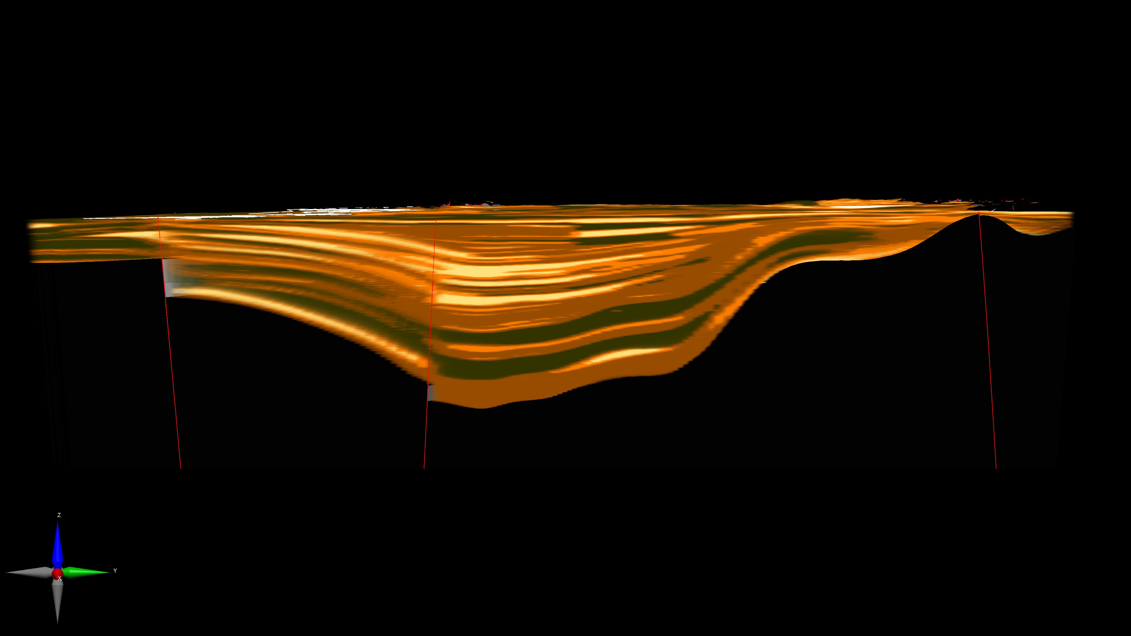
Three-dimensional lithologic model of the Los Angeles Basin within Los Angeles County. View is due west with a vertical exaggeration of 4:1. The layers are colored according to their ability to transmit water; the lighter colors indicate permeable sand and gravel layers, the darkest are relatively impermeable silts and clays. Red lines indicate earthquake faults. Geometry of the layers constrained by a sequence stratigraphic model of Quaternary-age deposits of the Los Angeles Basin developed by Daniel J. Ponti, USGS.
References
Ponti, Daniel J., Ehman, Kenneth D., Edwards, Brian D., Tinsley, John C., III, Hildenbrand, Thomas, Hillhouse, John W., Hanson, Randall T., McDougall, Kristen, Powell, Charles L., II, Wan, Elmira, Land, Michael, Mahan, Shannon, and Sarna-Wojcicki, Andrei M., 2007, A 3-Dimensional Model of WaterBearing Sequences in the Dominguez Gap Region, Long Beach, California: U.S. Geological Survey
Open-File Report 2007-1013, 34 p.
Ponti, D.J., Wagner, B.J., Land, M., and Landon, M.K., 2014, Characterization of potential transport pathways and implications for groundwater management near an anticline in the Central Basin area, Los Angeles County, California: U.S. Geological Survey
Open-File Report 2014-1087, 75 p. and appendix