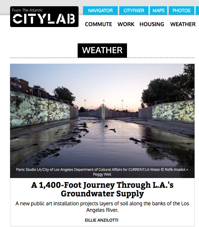
Source: A 1,400-Foot Journey Through L.A.’s Groundwater Supply, The Atlantic CityLAB, Eillie Anzilotti, August 4, 2016
A new art installation, UnderLA, adds another dimension to the reach of the drought. At two sites along the concrete banks of the L.A. River—the First Street Bridge and the river’s origin at the intersection of Arroyo Calabasas and Bell Creek—the artists Peggy Weil and Refik Anadol have projected a slow-moving journey 1,400 feet below the surface of the city. Scrolling through images of soil samples taken at intervals of 10 feet, the projections—commissioned by the City of Los Angeles as part of L.A.’s first public art biennial, Current:LA Water—detail the increasingly stressed and vulnerable aquifer system underpinning the city.
In a sense, Weil says, the installation is “a straightforward photographic landscape of these incremental soil samples.” The artists worked with researchers from the U.S. Geological survey to photograph soil samples taken from two Los Angeles wells, both located close to the projection sites; interspersed throughout the scrolling videos (below) are USGS data testifying to fluctuating water levels at those same well sites.
But watching the video play across the wide swaths of riverbank is a transformative experience. “As you descend in space, you’re also going back in time—at 1,400 feet, you’ve gone back 2.5 million years,” Weil says. In each aquifer layer, “there are recognizable fragments: shells, little bits of wood, colored rocks—things you’d see on the surface layer,” she adds. “But it’s incredibly moving to realize that they’ve been underground for that long, and that they’re forming a foundation we still depend on.”

